When hikers and a motocross rider meet at the trailhead
Plan a hiking and motocross trailhead meetup with legal routes, one shared base, respectful trail etiquette, offline backups, and safe check-ins.
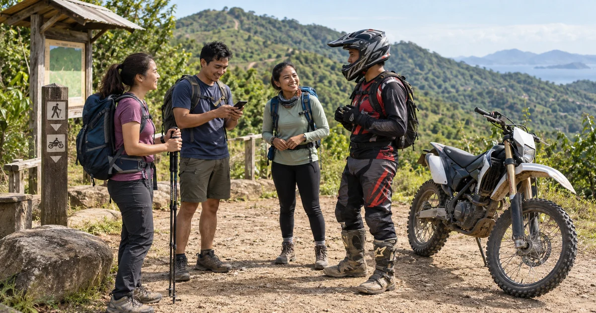
The hikers reached the trailhead on foot. Their friend arrived in helmet, boots, and protective gear, then switched off his dirt bike beside the designated motorized entrance. They were heading into the same landscape, but not necessarily along the same trail.
That distinction made their hiking motocross trailhead meetup safer and easier to plan. The goal was not to force different activities into one route. It was to share a clear base, respect the land rules, and meet again without guessing.
Confirm that each route allows the activity
A track visible on a map is not automatically open to motorcycles, and a motorized route is not automatically a comfortable walking trail. Check the current information from the land manager, local government, park office, or trail operator before leaving home.
Look for:
- Designated hiking and motorized routes
- Temporary closures and weather restrictions
- Required permits, registration, or protective equipment
- Opening and exit times
- Rules for parking, noise, speed, and group size
- Emergency contacts and the nearest staffed point
The U.S. Forest Service’s shared-trail guidance notes that hikers and off-highway vehicle riders can share some trail systems when users cooperate and respect one another. But the local designation always matters. BLM guidance similarly tells riders to obey route signs, respect private property, and follow the regulations for the land they are using.
If the operator separates hiking and motorized routes, the group should do the same. Friendship is not permission to ride onto a foot-only path or walk into a restricted riding course.
Make the trailhead the shared base
The group chose the map board beside the legal parking clearing. It was visible, away from the moving trail entrance, and specific enough that “I’m here” meant the same place to everyone.
They agreed on three times:
- A departure check at the trailhead
- A midday reunion at the same base
- A final check-out before anyone travelled home
The hikers carried their own route plan. The rider had a separate motorized loop and return time. Nobody expected the faster vehicle to shadow the walking group or act as an improvised rescue service.
Exchange the details that actually matter
Before separating, every participant knew:
- The route each person intended to use
- The expected return window
- Clothing, equipment, and vehicle description
- Medical or accessibility information the group needed to know
- Who to contact if a person missed the check-in
They also left their itinerary with a trusted person who was not on the trip. Official BLM recreation guidance recommends leaving the trip location and expected return time with somebody else, keeping off-road vehicles in good condition, wearing protective equipment, and staying on designated routes.
A group chat is helpful, but it is not a search-and-rescue plan.
Respect different speeds and trail experiences
When motorized users and hikers meet on a route where both are permitted, the safest response is predictable and courteous. Riders should slow well before reaching people, remain in control, reduce dust and noise, and follow posted yielding rules. Hikers should stay visible, avoid blocking the route, and not assume the rider can stop instantly on loose or steep terrain.
Do not invent a universal right-of-way rule from memory. Practices and regulations vary. Read the signs at that trail system and follow staff instructions.
The rider in this group parked before joining the hikers for lunch. The engine stayed off while everyone talked. Their meetup point was a resting place, not part of the riding line.
Use Nearby where connectivity supports it
At the trailhead, one person created a meetup in Nearby, placed the pin on the map board, and shared the link. Invited friends could join from the Android app or a browser, including on iPhone, and choose whether to share their location.
The map was useful while everyone approached the base and again when they returned within mobile coverage. The chat held simple status messages such as “back at the map board” and “rider delayed 15 minutes but safe at the southern checkpoint.”
Nearby is not an off-road navigator, topographic map, emergency beacon, or trail-permission database. Coverage can disappear, batteries drain faster in weak signal, and phone GPS may drift. Save an offline map where appropriate, carry the equipment required for the terrain, and agree on a time-based response if messages do not arrive.
Do not follow another person’s location marker off a designated route. If someone is overdue, use the trail operator’s emergency procedure and give responders the person’s planned route and last confirmed contact.
End together without travelling the same way
At the afternoon check-out, the hikers returned dusty and tired. A few minutes later, the rider rolled into the clearing, parked, and removed his helmet. Different routes had produced different stories, but the shared base gave the day one clear ending.
They checked the roster, closed the meetup, and left separately - the hikers in a waiting vehicle and the rider with his own transport plan.
Good outdoor coordination does not require everybody to move at the same speed. It requires legal routes, realistic return times, respect between trail users, and one safe place where the group knows how to reconnect.
Use Nearby to coordinate at the trailhead, with offline navigation and local trail rules leading the trip.
Common questions
Can hikers and motocross riders use the same trail?
Only where the land manager permits both uses. Trail rules vary, so check current signs, closures, permits, and designated motorized routes before the trip.
Where should a mixed outdoor group meet?
Use a legal, visible trailhead or parking area away from the active riding line. Choose an exact landmark and a separate fallback outside the trail system.
Can Nearby replace an offline trail map or emergency device?
No. Nearby depends on phone location, power, and connectivity. Carry the navigation and emergency equipment appropriate for the area and leave a trip plan with someone who is not joining.