What to do when volcanic ash disrupts group travel
Build a volcanic ash group travel plan around official bulletins, indoor shelter, respiratory protection, transport changes, and check-ins.
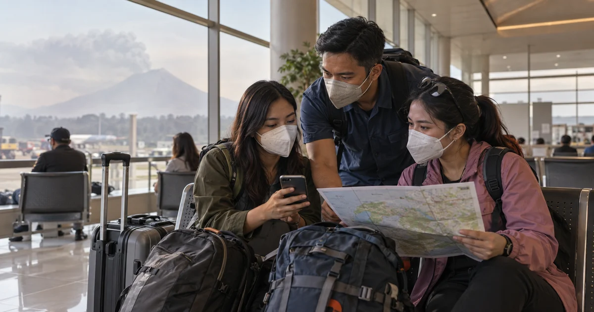
Volcanic ash can disrupt a group trip far beyond the volcano itself. Flights may change, roads can become hazy or slippery, outdoor stops may no longer be sensible, and one traveler’s respiratory condition can change the safest plan for everyone.
A volcanic ash group travel plan starts by pausing the itinerary. The priority is not reaching the next attraction or rescuing a booking. It is following official instructions, reducing exposure, and accounting for every traveler without sending anyone back into an affected area.
Follow the bulletin, not the view from the window
Ashfall at your location does not reveal what is happening near the volcano. Likewise, a clear sky does not mean a road or destination is outside a danger zone. Use current bulletins from DOST-PHIVOLCS and instructions from local disaster officials.
PHIVOLCS explains that volcanic hazards can include ashfall, ballistic projectiles, pyroclastic density currents, volcanic gas, lahars, and landslides. Its volcano preparedness page collects ashfall guidance, while activity bulletins specify danger zones and local recommendations for a particular volcano. Never enter a permanent or extended danger zone because a navigation app suggests a shorter road.
Choose one group coordinator to monitor official updates and transport notices. Every update shared in the chat should include its source and time: “PHIVOLCS bulletin at 2:50 PM,” not “someone said it is improving.”
Move indoors when authorities advise shelter
If officials tell the public to shelter from ash, use an enclosed building and limit unnecessary trips outside. Close doors and windows as directed by local guidance, keep luggage together, and identify the reception desk or another staffed indoor landmark where separated travelers can report.
The CDC’s volcano safety guidance notes that ash can irritate the lungs and eyes and may create slippery, hazy driving conditions. Infants, older adults, and people with asthma or other respiratory conditions can be especially vulnerable. CDC guidance also recommends a NIOSH-approved N95 respirator to protect the lungs from ash.
A mask does not make an evacuation zone safe, and a loose face covering is not a reason to extend outdoor activity. Follow health guidance on fit and use, and seek medical help for breathing difficulty or other urgent symptoms.
Account for people before rearranging transport
Make a quick roster with three statuses:
WITH GROUP- physically present at the indoor meeting pointSAFE ELSEWHERE- confirmed at another safe, staffed placeUNCONFIRMED- no recent direct contact
Record the time of each confirmation. Do not label somebody safe because their location marker has not moved.
For an unconfirmed traveler, call or text, check the last agreed indoor landmark, and contact venue or transport staff. Give authorities the person’s last confirmed location and plans when there is a genuine emergency. Do not send another traveler outdoors to search during hazardous ashfall.
Rebook only after checking the whole route
Ash can affect airports, ports, roads, and public transport differently. Check the operator responsible for each segment and the local authority at both the departure and arrival points. A flight cancellation may make an indoor hotel stay safer than a long road transfer through an affected area.
Before choosing an alternative, ask:
- Does the route cross a declared danger or evacuation zone?
- Are visibility, ash, lahars, or road closures affecting it?
- Can every traveler use the replacement transport safely?
- Is the destination open and able to receive the group?
- Is there enough medication, water, battery power, and money for a delay?
Keep essential medicine, identification, protective equipment, water where safe to drink, and chargers in carry-on bags. Do not leave shelter solely to retrieve nonessential luggage.
Use Nearby for a confirmed safe meeting place
When the group has a safe indoor location approved by venue staff or local authorities, Nearby can help invited travelers find the same entrance or reception point. One Android user starts a meetup and shares the link; invited participants can join through the app or a browser, including on iPhone. Location sharing remains each person’s choice.
Use the group chat for short sourced updates and put the pin on the indoor staffed landmark - not on the volcano, a roadside viewpoint, or a closed terminal. End the meetup when coordination is complete rather than turning temporary sharing into continuous monitoring.
Nearby does not receive PHIVOLCS alerts, measure air quality, forecast an ash plume, validate roads, or call emergency services. GPS and data can also become unreliable. Official bulletins and local instructions always determine whether the group shelters, evacuates, or travels.
The most successful adjustment may be an uneventful afternoon indoors. When a group protects lungs, verifies every person, and waits for reliable information, changing the trip becomes a safety decision rather than a disappointment.
Use Nearby for temporary coordination at a confirmed safe location after checking official volcanic-hazard guidance.
Common questions
Should a travel group continue driving during volcanic ashfall?
Do not assume driving is safe. Ash can reduce visibility and make roads slippery while official closures or evacuation orders may apply. Follow PHIVOLCS, local authorities, and transport operators before moving.
What mask helps protect against volcanic ash?
CDC guidance recommends a NIOSH-approved N95 respirator for ash exposure. Fit and individual medical needs matter, so follow public-health advice and prioritize indoor shelter when instructed.
Can Nearby track volcanic ash or evacuation zones?
No. Nearby does not monitor eruptions, ash plumes, air quality, road safety, or evacuation boundaries. Use official PHIVOLCS and local government information, with Nearby only for temporary group coordination.